South Devon National Landscape
Follaton House, Plymouth Road,
Totnes TQ9 5NE


Tel: 01803 229330


Kingsbridge to Frogmore circular (7.5m)

Category
Moderate to Strenuous
About This Project

Kingsbridge to Frogmore circular – Creeks and countryside

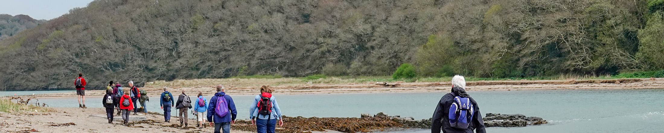
A 7.5 mile walk exploring some of Kingsbridge estuary’s creeks – Bowcombe and Frogmore. Steep in places but the views are worth the climb!


Geocache
This walk is very near to a hidden National Landscape geocaches –  ‘What makes South Devon special 9’

Information about our geocaches and how to find them here.

Overview

Start
Quay car park, Kingsbridge TQ7 1JD
Distance
7.5 miles
Difficulty
Moderate to strenuous. Steep ascent and descent, 6 stiles
Terrain
Surfaced and unsurfaced paths.
Parking
Quay car park, Kingsbridge TQ7 1JD
OS map
Explorer OL20
Grid Reference
SX 735 439
Public transport
Buses to Kingsbridge - see www.travelinesw.com
Refreshments
In Kingsbridge, West Charleton and Frogmore
Toilets
Public toilet in car park.

Directions

  1. Turn right out of car park along The Promenade. Turn left into Derby Road, and at the crossroad turn right, still in Derby Road.
  2. At the bottom of the dip follow road up to the left and where road turns sharp right. Ignore this and go straight on up the green lane.
  3. Climb steadily to the top, and half way down the other side take Public Footpath over stile on right. Descend steeply and cross the road at the bottom by two stiles. Take footpath to the head of Bowcombe Creek. (A bit of paddling here across stepping stones if it’s very wet.)
  4. Cross the causeway and take FP straight ahead up the hill. When you reach the road, turn right and follow it up to Duncombe Cross. At the Cross go straight on along the green lane.
  5. In 1 mile another lane joins from the left. Keep on down the hill to the main road. Turn left and walk towards the village, taking great care on this busy main road.
  6. Turn right onto public footpath signed for Frogmore Creek and West Charleton. Follow path around field edge and along above creek.
  7. Eventually the path drops down onto the foreshore. After 200m follow the ‘Public Footpath’ sign inland.
  8. When you meet the lane go straight on.
  9. On the corner by the fire beacon basket turn left through metal gate and down public footpath through field.
  10. At the bottom the path follows the field edge left, then turns right through the hedge bank.
  11. Walk up field to next waymarker, then sharp left onto public footpath following farmer’s track through field.
  12. At the lane turn right. At main road turn left along the footpath.
  13. Turn left along the road to the church. Turn right up Church Lane.
  14. Take the footpath to the left, just before the allotments. Walk 3/4 mile back to the head of Bowcombe Creek.
  15. Turn left onto the bridge and follow the footpath back to the road.
  16. Take the left hand footpath across and up the steep field. Cross the stiles, keeping to the hedgeline back towards the Rugby club.
  17. Keep right through rugby club car park.  Cross road and stile onto footpath down steep scrubby field.
  18. Join the road left, then turn immediately left through the recreation ground.  At the road, cross and turn right to follow the creek back to the car park.

Related Pages

Downloads

Listen to audio

Salcombe Tide Times

Salcombe Weather