South Devon National Landscape
Follaton House, Plymouth Road,
Totnes TQ9 5NE


Tel: 01803 229330


Avon Estuary (7.5m)

Category
Moderate
About This Project

Avon estuary walk – A meander through peaceful countryside and woodlands

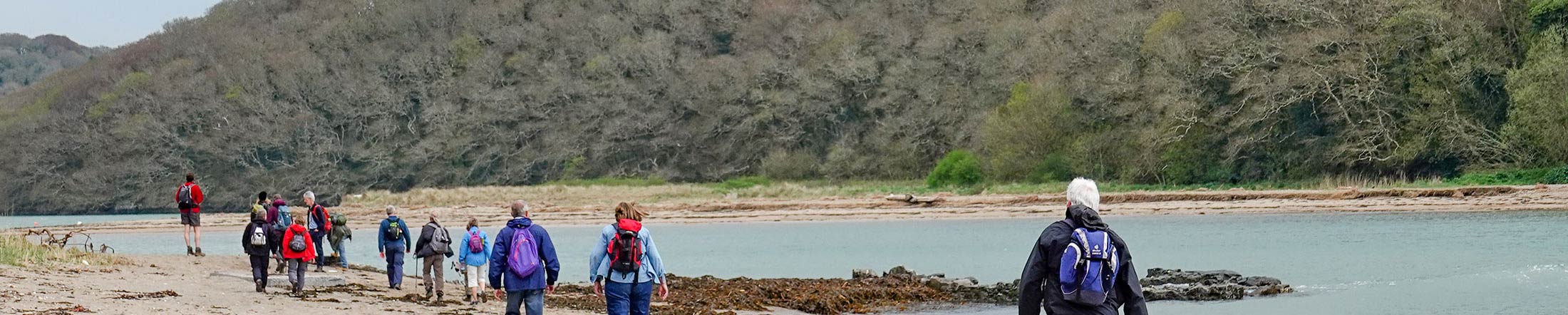
Downstream from Aveton Gifford, the river Avon winds through its beautiful and secluded valley to the sea. This fine walk traces its course, and you are rarely out of sight of the estuary, or its rich birdlife.


This walk crosses one of our estuaries, make sure you check the ferry timetable to help plan your route.

Geocache
This walk includes three hidden National Landscape geocaches – ‘Your South Devon Landscape 4, 5 and 6’ . Information about our geocaches and how to find them here.

Overview

Start
Bantham Sands car park, or Timbers car park, Aveton Gifford (start at point 9)
Distance
7.5 miles ( 8.5 miles at high tide)
Difficulty
Moderate walk, Stiles, 3 flights of steps, steep ascent and descent. More on high tide route.
Terrain
Footpaths and lanes, some unsurfaced paths which can be muddy in wet weather
Parking
Bantham Sands , TQ7 3AN and Timbers car park, Aveton Gifford, TQ7 4LT
OS map
Explorer OL20
Grid Reference
SX 665437
Public transport
Buses to Aveton Gifford - see www.travelinesw.com For ferry times see link above
Refreshments
In Bantham and Aveton Gifford
Toilets
In Bantham Sands car park and Aveton Gifford village

Directions

This route follows the blue ‘Avon Estuary Walk’ waymarkers.


  1. Walk back to the turning circle by the car park entrance and turn left down to the quay. Take the ferry from here across river (the ferry operates a seasonal service, see the ferry information panel at Bantham or the National Landscape website for further details).
  2. From ferry information panel at Cockleridge head inland and up steps. Follow field edge up, and then to left, then bear right up road alongside and across golf course.
  3. By a turning bay and waymarker on left, turn right over cattle grid and down drive. Walk through houses at Hexdown, then bear right down footpath. Turn left at the bottom to follow private drive.
  4. Just before you meet road, turn right into field and follow ‘Permissive Footpath’ fingerpost along field edge. Halfway across second field, turn right across field signed ‘Milburn Orchard 1 ½m’.
  5. Bear left over the stile and left again at a fork in the woods. Follow waymarked path along field and terrace, dropping gradually downhill.
  6. Turn left along the foreshore, and then right along tidal road to Aveton Gifford. At low tide jump to point 10.
  7. Alternative route at high tide: Turn left along foreshore as above, but go straight across at road onto public footpath over stepping stones and through grounds of Milburn Orchard above creek. Turn right along a track, bear right where you meet a fork, and turn right along the road. After 200m bear right up green lane signed ‘Drunkard’s Hill’.
  8. At top of rise, bear right onto footpath across fields and down through the dip. Turn left along the lane, then sharp right by Skipper’s Hill Cottage. Cross at the main road and take the path opposite, bearing right onto path above road.
  9. At the bottom turn right through the underpass into the car park. Turn left out of car park onto road.
  10. At mini- roundabout turn right along main road over river. Cross by Bridge House onto permissive path alongside road. Re-join road again over bridge, then path once more, to finally cross the road and follow lane opposite at Bridge End.
  11. At the top turn right along lane. At Higher Stadbury bear left onto footpath and bear left again where you join a further footpath.
  12. Follow path along right hand field edges and then down between fences. Turn right through the gate and follow right hand field edge. Just before the next field gateway, leave the well- walked path and drop down the field to the left. Bear right at the bottom.
  13. Through two gates, cross Stiddicombe Creek via footbridge to left. Turn right through gate then bear up through field past waymarker post. Cross stile into wood and follow waymarkers.
  14. Follow path along field edges above river, through gate on to track. By fingerpost signed ‘Bantham 1/2 mile’ fork right onto the footpath down between stone walls. Go through gate and turn right at gate on to next track. At road turn right down through Bantham and back to the car park.

Related Pages

Downloads

Listen to audio

Salcombe Tide Times

Salcombe Weather