South Devon National Landscape
Follaton House, Plymouth Road,
Totnes TQ9 5NE


Tel: 01803 229330


The River Erme – Ivybridge to Ermington (8.5m)

Category
Moderate
About This Project

The River Erme : Ivybridge to Ermington – from the edge of the moors into the National Landscape

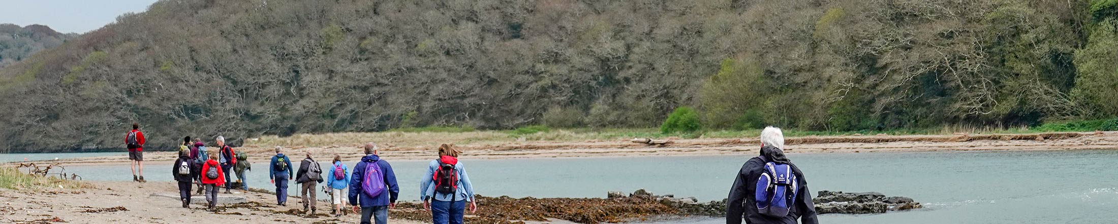
A lovely wander following the valley of the River Erme, in an area where the wild beauty of the moor and the mellow delights of rolling South Devon meet and merge.

Overview

Start
Glanvilles Mill/Leonards Road Car Park, Ivybridge. PL21 0SL
Distance
8.5 miles
Difficulty
Moderate. Many stiles (3 can be bypassed); 1 flight of steps. Busy main road
Terrain
Footpaths, often through fields; fairly even underfoot, occasional mud after rain; surfaced roads.
Parking
Glanvilles Mill/Leonards Road Car Park, Ivybridge. PL21 0SL
OS map
Explorer OL20
Grid Reference
SX636561
Public transport
Buses and trains to Ivybridge, see www.travelinesw.com
Refreshments
In Ivybridge and Ermington
Toilets
In car park

Directions

For much of its length, the walk follows the green and white Erme–Plym Trail / Coast to Coast waymarkers.


  1. From the Leisure Centre in Ivybridge, take the riverside path downstream. Walk along the main road then turn right opposite the recycling centre and follow path around edge of playing fields.
  2. Turn right along the road, then right again onto a footpath front of Yeo Bungalow, across fields and along river.
  3. Turn left at road, and then first right at Caton Cross. After 200m bear right through a metal gate, and across fields. Bear left, walking uphill to get top next gate when crossing an open field via the telegraph pole, and follow the next field edge to the road. Turn right. At main road, take footpath opposite and to left, signed ‘Sequer’s Bridge’.
  4. Follow yellow waymarker arrows across fields, following the river before looping up the hill. Cross a wooden stile, passing though a farm towards the main road
  5. At the main road turn right then right again to follow the riverside path back up towards Ermington.
  6. Cross the main road and after 220m turn left up Town Hill into Ermington. Walk up to the village pub at the top.
  7. Take cobbled path to right of pub and cross fields to the church. Drop straight down from church to road and turn right. Turn first left down road past the school.
  8. At main road turn left over bridge, then left again up lane signed for Penquit and Strode. From here you are retracing your earlier steps.
  9. Turn left beyond brow of hill onto public footpath and follow yellow waymarkers back through fields.
  10. Bear left at the road. Turn left at Caton Cross. Turn right just before Keaton Bridge onto riverside Where path enters field, fork away from river along remains of green lane and field edge.
  11. Turn left onto footpath alongside road. After 200m, turn left and follow path around back of playing fields alongside river. Turn left opposite recycling centre and follow river back to car park.

Related Pages

Downloads

Listen to audio

Salcombe Tide Times

Salcombe Weather